


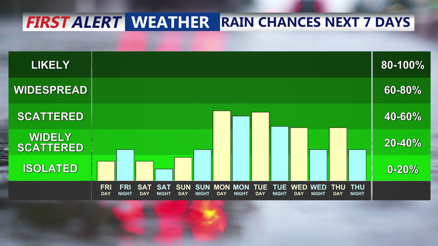


DELMARVA -- Any lingering pop-up showers are forecast to taper off by this evening. As onshore flow continues, areas of low clouds or patches of fog developing overnight into early Saturday. Use caution overnight as we may see limited visibility in spots near the coast and along inland waterways.

A cold front will bring another chance for scattered showers and storms, some strong to severe Monday.
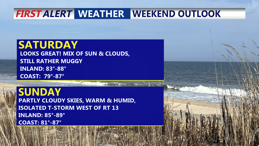
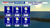
Saturday is shaping up to be partly cloudy, warm, and humid across Delmarva. High temperatures will range from the mid to upper 80s inland to the low to mid 80s at the beaches. A low rip current risk will be present along the Atlantic shoreline. Thunderstorm chances on Saturday should stay mainly west of the peninsula, leaving most of the area dry for outdoor plans. By Saturday night, another round of low clouds and potentially patchy fog is expected to redevelop as mild, moist air lingers over the region. Overnight lows will hold in the low 70s.

Very nice beach day shaping up Saturday, some morning fog, highs in the 80s, low rip current risk.
Similar conditions will continue Sunday, with partly sunny skies and muggy air. Highs will once again climb into the mid to upper 80s. While most of Delmarva should remain rain-free, there is a slight chance of an isolated thunderstorm over the Eastern Shore and areas west of Route 13. The greatest risk of stronger storms Sunday will remain north and west of the region.
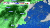
Monday will bring increasing shower and thunderstorm coverage as an upper-level trough moves into the Eastern U.S., although the system will weaken as it approaches. Despite limited upper-level support, strong daytime heating and added lift along an approaching cold front will promote more widespread showers and storms, especially during the afternoon and evening.

Cold front brings another round of scattered showers and storms Monday late afternoon -evening, some severe storms are possible.
The severe weather threat is expected to stay low, but a few stronger storms with gusty winds and brief downpours can’t be ruled out. Highs Monday will remain in the 80s, with mild overnight temperatures in the 60s and 70s as the cold front crosses Delmarva late Monday night into early Tuesday.
Forecast confidence decreases after Tuesday as the cold front is expected to slow down and stall over or just south of the area. This stalled boundary may trigger another round of scattered showers and thunderstorms on Tuesday. Looking further ahead, Canadian high pressure may begin to build over the Northeast and Mid-Atlantic by mid to late week, which could suppress thunderstorm activity somewhat. However, given the persistent July heat and humidity, occasional afternoon convective showers or storms will still be possible.
Daytime temperatures will likely remain above normal all week, with highs frequently in the upper 80s to low 90s. In some locations, heat indices could climb toward or above 100 degrees.