


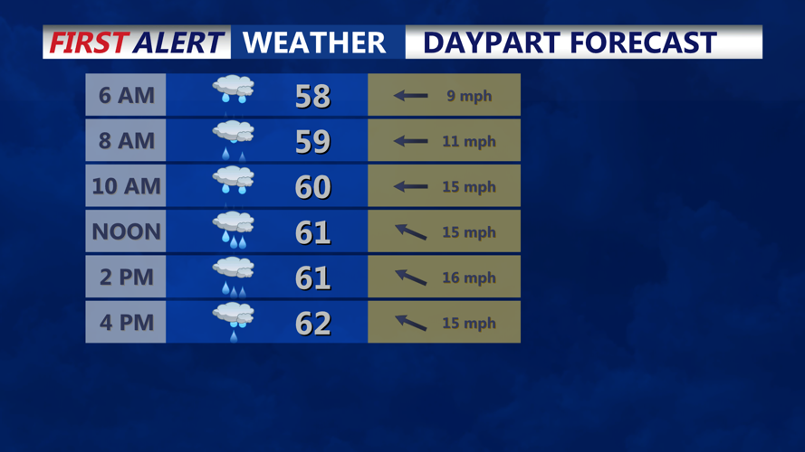


DELMARVA - A shift in the weather pattern is on the way for Sussex County as a storm system moves in from the west and redevelops along the Atlantic Coast, bringing rain and cooler temperatures through midweek. High pressure currently in place will slide offshore as a storm system takes shape. A surface low will move east from the Tennessee Valley, and pressure will begin to fall across the Mid-Atlantic. As clouds increase and an onshore flow strengthens, overnight temperatures will remain relatively mild—lows ranging from the low 50s inland to the upper 50s along the coast. Rain chances will increase overnight, especially toward dawn Wednesday.
Wednesday:
A double-barreled low pressure system—one over the Ohio Valley and another developing near the Carolina coast—will bring widespread rain into the region. Although dry air from a departing high pressure system to the northeast may slow the initial onset of rain, showers are expected to reach all areas by Wednesday night. The heaviest rainfall will likely be near the developing coastal low, with Sussex County expected to receive up to an inch of rain.
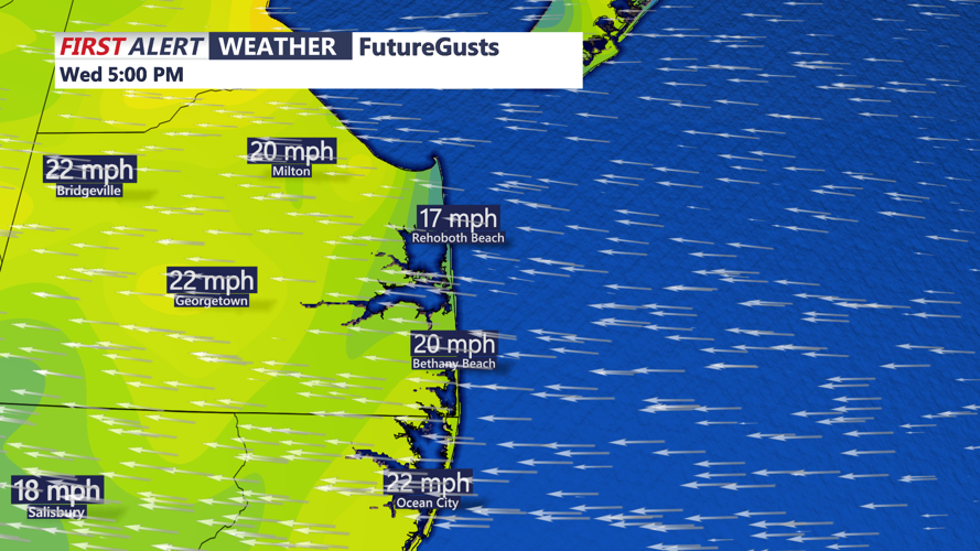
Cloud cover, precipitation, and an influx of cooler Canadian air will keep high temperatures suppressed, with many areas struggling to reach the 60-degree mark. Breezy northeast winds will add to the chill.
Wednesday Night into Thursday:
Temperatures will remain steady in the 50s overnight Wednesday. The rain and gusty conditions will persist, making for a damp and cool night. By Thursday morning, the storm system is forecast to slowly push northeast. While some models indicate showers could end by 8 a.m., others suggest lingering rain well into the day. Expect a gradual tapering of precipitation and the potential for breaks in cloud cover by late afternoon. Should skies clear, temperatures could rebound into the low 70s.
Thursday Night Outlook:
The region may see another round of showers late Thursday night due to a stalled frontal boundary and another weak disturbance approaching from the west. Lows will remain mild, generally in the 50s.
Residents are advised to keep rain gear handy and stay updated with the latest forecasts, as this dynamic system continues to evolve.