


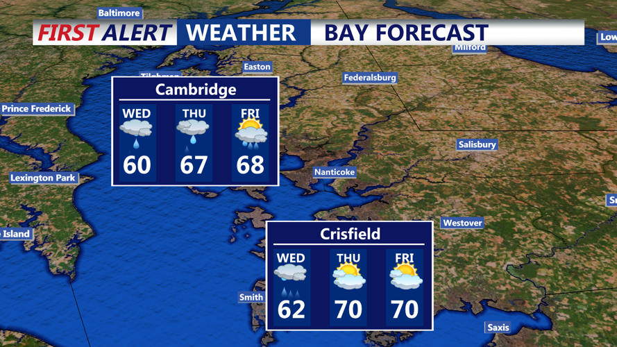


DELMARVA - Light rain will begin to spread from west to east after midnight as a low-pressure system enters the Ohio Valley. Initially, dry air near the surface may delay the onset of steadier rain, but by daybreak Wednesday, widespread precipitation is expected. Overnight lows will remain mild, dipping into the upper 40s to mid-50s due to thickening clouds and onshore winds.
Wednesday: Rain Intensifies, Temperatures Drop
Rain is expected for much of Wednesday, driven by upper-level disturbances and warm air advection. A new coastal low will begin developing off the Mid-Atlantic shoreline, enhancing rainfall. Periods of moderate to heavy rain are likely, particularly Wednesday afternoon and evening. Some brief breaks in the rain could occur, particularly in southern Sussex County, but showers will dominate the day.
Wednesday Night:
As the coastal low intensifies and moves offshore near New Jersey, rain could become heavier once again. The chance for locally heavy downpours increases, especially near the coast, where rainfall totals may reach between 1.0 to 1.5 inches. Isolated flooding in poor drainage areas is possible. A few rumbles of thunder can’t be ruled out, especially across the Delmarva Peninsula.
Wind and Coastal Impacts:
Onshore winds will ramp up by Wednesday night, with gusts between 30 to 40 mph possible—strongest along the beaches. These winds could contribute to minor coastal flooding and rough surf conditions, particularly late Wednesday into early Thursday. Mariners and beachgoers should exercise caution.
Thursday and Beyond:
By Thursday, the low will move northeastward, and winds will shift to the north and northwest, gradually diminishing. Rain may taper off to scattered showers during the day. Cooler conditions will persist with highs struggling to rebound. Friday looks breezy and unsettled, with a lingering chance of showers. The Memorial Day weekend is trending drier and milder, though temperatures will remain below average through at least Sunday.