


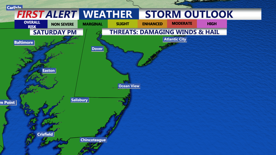


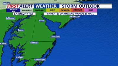
DELMARVA - Saturday afternoon into Saturday night will see a return of unsettled weather as another upper-level disturbance swings around a low pressure system parked over Quebec and Ontario. A cold front approaching from the west will interact with the system to provide enough atmospheric lift for showers and scattered thunderstorms. While there remains some uncertainty about the amount of instability that will develop, we may see some stronger storms.

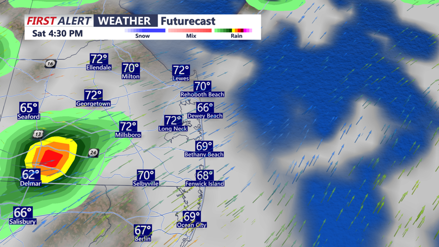
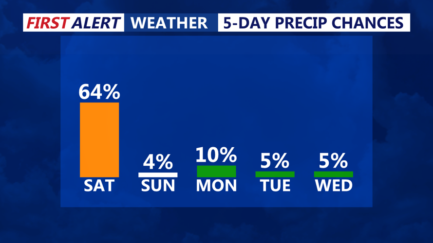
Scattered showers and storms develop Saturday afternoon into the early evening.
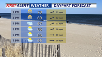
The main threat from these storms will be damaging wind gusts, though small hail is also possible due to colder air aloft. Heavier downpours may cause localized flooding, especially in urban or poor drainage areas. Temperatures during the day will hover in the upper 60s to low 70s.

Scattered gusty t-storms are possible through the early evening.
By Saturday night, most of the precipitation will taper off as the cold front moves offshore. Skies will begin to clear thanks to cold air advection, and overnight lows will dip into the mid to upper 40s and low 50s across the region.

High pressure moves in next week as temperatures trend more summer-like.
Sunday will mark a shift to drier and breezier conditions. A beautiful day to finish out the weekend. One last weak disturbance may bring scattered cumulus clouds, but no significant precipitation is expected as moisture will be limited. Winds will pick up in the wake of the front, with gusts between 20 to 30 mph possible. Temperatures will be slightly below normal, with highs in the mid to upper 60s and low 70s.