


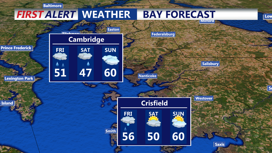


DELMARVA - A low-pressure system will approach the Mid-Atlantic region, leading to increasing cloudiness and the onset of rain showers in Sussex County's beach areas, including Rehoboth Beach, Bethany Beach, and Lewes. Temperatures are expected to be around 50°F (10°C) during the day, dropping to the upper 40s°F (8–9°C) overnight.
The coastal low will move closer to the area, bringing more widespread and heavier rainfall throughout the day. Winds will intensify, with gusts reaching up to 30 mph along the coast. High temperatures will remain in the low 50s°F (11°C), making for a cool and damp day.
Impacts and Recommendations
Rainfall: Expect total precipitation amounts between 0.5 to 1 inch through Friday night. While widespread flooding is not anticipated, localized flooding in low-lying and poor drainage areas is possible.
Winds: Gusty northeast winds may lead to minor coastal flooding, especially during high tide cycles.
Temperatures: Below-normal temperatures will persist, with highs struggling to reach the low 50s°F.
Recommendations:
Residents and visitors should secure outdoor items and exercise caution when traveling, especially near coastal areas.
Stay updated with local weather forecasts and advisories.
Dress appropriately for cool and wet conditions if planning outdoor activities.
Looking Ahead
Conditions are expected to improve by Sunday as the low-pressure system moves offshore, allowing high pressure to build in. This will lead to drier weather and a gradual warming trend into early next week.